
To Palmerston North, Dec 10-15, # 11
Whanganui River Road ~ Part of Te Araroa route
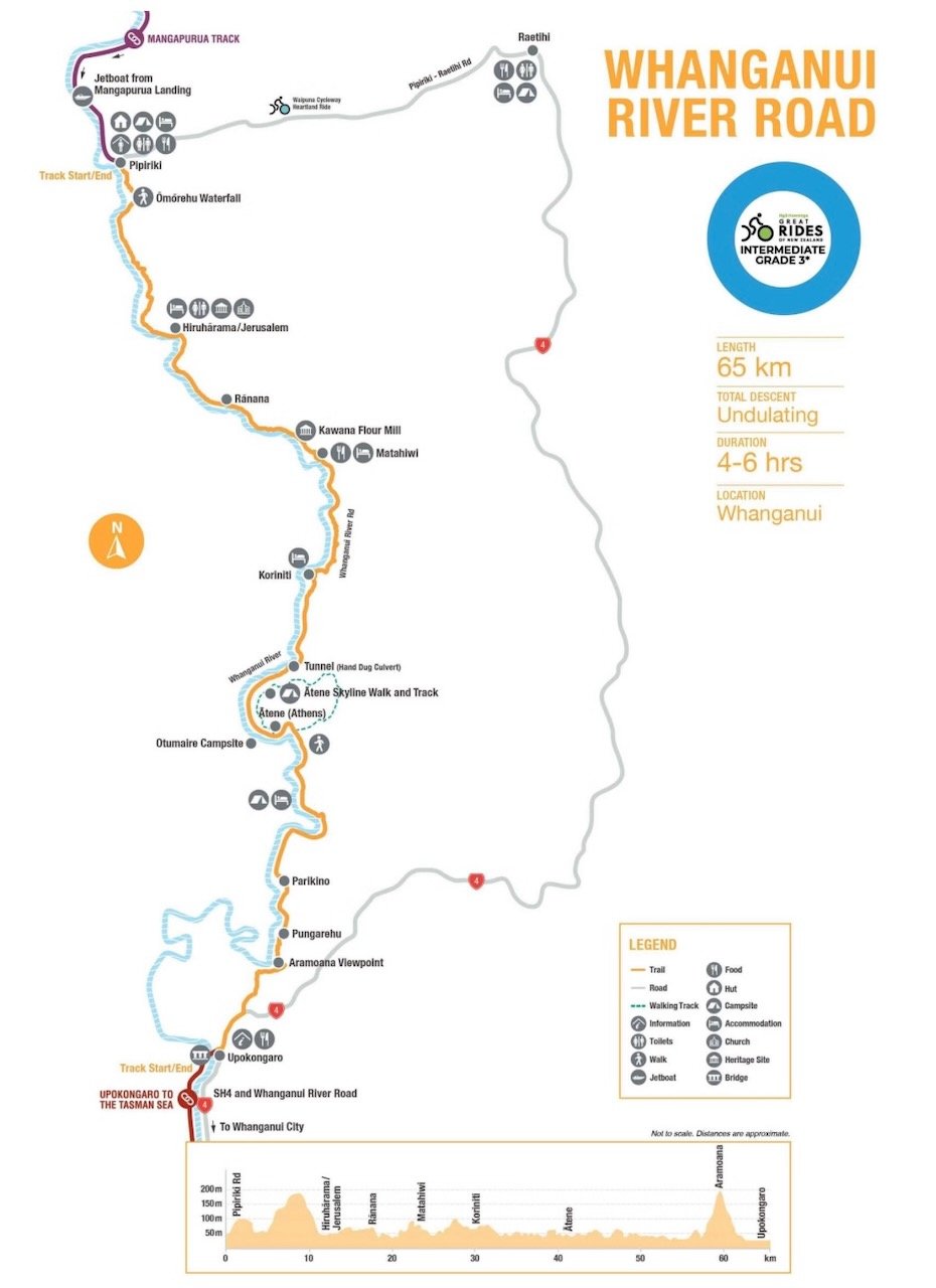
Whanganui River Road ~ A true Country Lane

Fern Grotto along Whanganui River Road
After two nights in Pipiriki, blue skies returned. The backpackers left by kayak, and us bike packers joined the river road with a flow all its own. The road was exceptional, following closely to the river, often high above the banks to give us expansive views up and down the valley. Sandstone cliffs and the rain forest flora dazzled us once again. It wasn’t long before we were left to meander at our own leisurely pace.


Being a quiet country road connecting small rural communities, we appreciated not having to constantly check our rear view mirror. Instead it was unexpected encounters that caught us off guard.
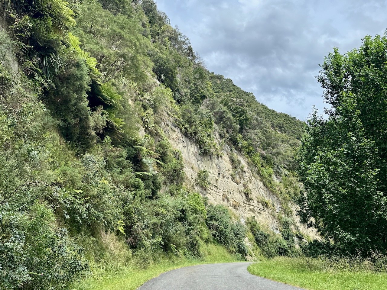
Our first encounter - a woman at the bottom of a hill, standing in the middle of the road, a big smile on her face and her hands outstretched. Unsure what to expect, we discovered she was holding out tangerines for us to grab on the fly. Her and her husband were on their way back from visiting family in the area and happened to have a bag full of tangerines from a local fruit market that they were more than happy to share with passing cyclists. We learned they had recently traveled the world on his yacht, after spending years competing in races around the world and winning more than once.
Our next encounter - cows with calves en masse trotting towards us followed by a ute, an ATV, and a massive bull, prodded onward with very focused cattle dogs. For the next several kilometers, we carefully dodged the evidence of their road-side trek splattered all over the road.
In the next community, we caught the attention of a couple Maori guys in front of their home eager to learn about our travels and to share their pride in the land we all enjoy. Another brief encounter reinforcing that good will continues to prevail.
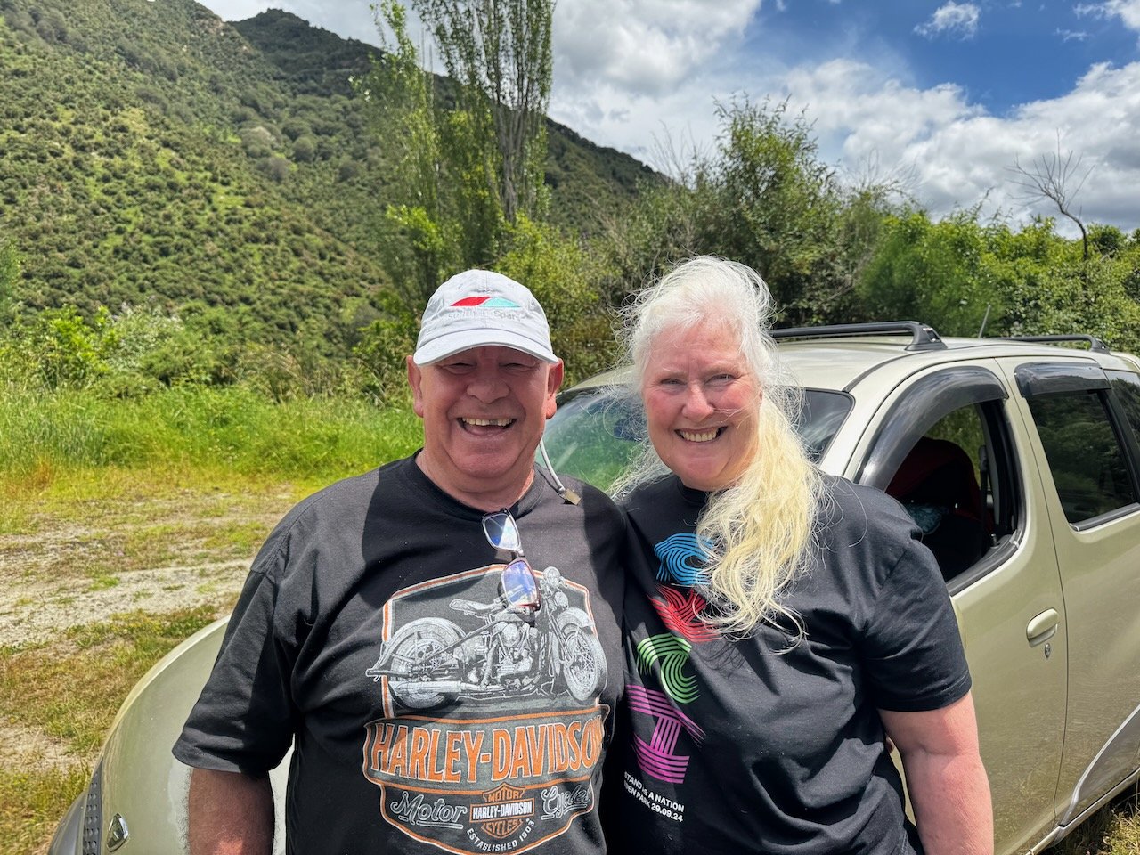


Further along we stopped to check out a hand-carved culvert, the walls still bearing evidence of the many pick axe swings made by early European settlers.


By the time we arrived at the only DOC site on the route it was late afternoon. Not wanting our ride down river to end, we decided to stay, even though the camp was simply a grassy pull out just off the road. Our only neighbor, a young guy from Bulgaria dropped off by taxi, he was hiking on the North Island for just a few weeks before returning home.


We woke to another picture-perfect sky, grateful for the clouds, as we approached our longest and steepest climb out of the river valley. Unfortunately the next section of river can only be accessed from roads on the other side heading up river from the highway.


After our descent to the other end of the Whanganui River Road and a short ride on Highway 4, we met up with the river again, and followed it to it’s end, in the town of Whanganui. At camp, we met up with our bike-packing friends from Pipiriki. They had already taken a rest day and were continuing on the Te Araroa route heading inland to reach Palmerston North in spite of the weather forecast. We opted to wait out the rain - and it came through in a torrent. Our first serious downpour since leaving Australia.


From here a direct route South to Palmerston North was a bit tenuous and included a 7km stretch on Highway 3 to cross the Whangaehu River. Having already traveled short distances on other state highways without issue, we figured it couldn’t be that bad, expecting it simply meant heavier traffic with more trucks. However, our friends from Yackandandah had warned us of a section on the North Island where there was “no safe way” to get down the coast - the following day, we discovered why…
Highway to Hell/o…Bulls
Our plan was to take back roads, until we had no other choice than to get on State Highway 3 to cross the river, and then veer off on to side roads again to Bulls, 64km/40mi in total. After a pleasant ride out of town, winding our way through farmland, up and over hills unfettered, we spotted the highway up ahead and were surprised to see hardly any vehicles.
It appeared our concerns about riding next to a steady stream of traffic might not be the case. Even more so, we were surprised to turn onto a sizable shoulder, giving us a comfortable separation from passing trucks. Our spirits lifted, we continued on across the river, spying a climb ahead, as is typical after most river crossings, we didn’t give it a second thought…until it was too late.
The highway rounded a corner carved into the hillside putting us up against a rock wall and all at once our comfortable shoulder reduced to a thin sliver, before it literally disappeared, just as the road began to climb a long, steep hill. Even though the uphill lane expanded to include a “passing lane”, there was no shoulder or a meridian to separate the downhill traffic. Somehow, the light traffic we first experienced, exploded into an endless stream of vehicles and huge trucks accelerating around the corner to head up the hill with an equal amount of traffic flying down it. There was no where for anyone to navigate around us, as vehicles were trying to pass each other on both sides of the highway.


Instinctually, I jumped the curb realizing there was just enough ground for us to escape certain death and survey our situation. In all our days of cross-country riding thus far, I had never felt so trapped. After my own panic thoughts of “how ridiculous we must look to these motorists…even if someone wanted to stop and save us, there is no where for them to pull over” followed by “OMG, only a helicopter can save us now”, we realized there was actually enough ground between the curb and the barb-wire fence lining the pasture next to us that we could make our way up the hill through the long grass and stay off the road.
Of course, even that plan was not without issue, as there were pinch points where the fence came up to the curb next to the drains forcing us onto the road to pass, and then further up as the hillside dropped off the edge and the road curved to the right, there was of course a guard rail on our side that obliterated the path forward. At that point, we had to quite literally cross all three lanes to get on the inside of the curve, where there was no guard rail, only spiky Gorse bushes crowding us to the curb, to continue.
When we finally got to the top of the hill, the road opened up and a shoulder once again appeared, solely to accommodate a truck pull out, and an intersection with a farm road that to our dismay was “Not a Through Road”. What we had just climbed up, of course had to go down, and it was the same scenario in reverse, only worse - three lanes, no shoulder, no meridian and a guard rail. While I stood there in a daze, trying to work out how to once again navigate alongside the road, Nivaun definitively said “we just have wait for a break in the traffic…and GO for it!” Realizing it was probably the only real option - sanity be damned - we pushed away from the side of the road, as I yelled back “You’d better not get me killed!!”
Google Earth Images (visualize trucks, utes, caravans, cars en masse)


Somehow a miracle bubble surrounded us as we bombed our way down the winding hill with NO one behind us! The only witnesses to our daring feat - oncoming motorists. I expect most were in shock to see such a sight, realizing it meant we also climbed that bloody hill, except for one - a ute full of blokes, honking and cheering us on, as they sped past us up the hill.
And wouldn’t you know it, by the time we reached the bottom, the same shoulder we had enjoyed before entering the vortex of “Highway Hell” reappeared all the way into the next town. At which point, we found the first “Through” road heading South and took it. It wasn’t our planned route, but at that point, I was so emotionally drained, I couldn’t be told otherwise. Ironically, just a short distance up the road, a serene-looking park full of Pines appeared next to a small cemetery. Never did a grassy spot under a tree look so inviting. After regaining our sanity and refueling alongside the deceased, we felt alive enough to continue riding another 26km to Bulls - all on side roads.
Needless to say by the time we arrived at the caravan park, we were beyond exhausted, stunned and grateful to be DONE!


Placid Path to Palmerston North
We woke the next morning eager to get to Palmerston North. After sharing our death-defying experience with our Yackandandah friends, they told us about a commuter rail between Palmerston North and Wellington, covering almost 200kms. At this point - a train ride sounded perfect!
Better yet, it seemed as though we had earned some remuneration after our traumatic ride. From the very start of our route across the bridge leaving Bulls, all the way to Palmerston North, was on either a path or back roads with minimal traffic, NO hills and dare I say…we traveled at an average speed of 14.5 km/h or 9mph - an FKT for a fully-loaded touring fat bike - I have no doubt!


As soon as we reached Palmerston North, we rode straight into town to the first brewery we could find for a well-deserved post-ride meal plus dessert! It wasn’t long after that we reunited once again with our bike packing friends at the caravan park. Their route from Whanganui to Palmerston North albeit hotter, longer and more elevation was by far the preferred route.


A day later we were saying farewell once again to our friends hoping to meet up again somewhere on the South Island. Amazingly, we broke camp in time to catch the first train to Wellington at 6:30am ensuring there would be space for our bikes on the train. We were able to roll them on board fully loaded just like riding the commuter trains at home.
Our plan was to arrive early in Wellington to get our tires replaced at “Get Lost” bike shop recommended by a local bike-packer we met on the Timber Trail. And the next day, take the ferry to the South Island just ahead of the Christmas holidays to begin the second half of our tour around New Zealand!!

