
Impossible…The Old Ghost Road ~ Day 1, Jan 23

Just DO IT!
How many times in life do we do what we feel is Impossible? If the answer is never…it is time to rethink what living is about. The first time I learned of The Old Ghost Road was sitting in the comfort and warmth of a home shared with new friends in Yackandandah, Victoria, Australia - kindred spirits excited for their upcoming adventure riding across New Zealand. For Nivaun and I, at the time, this country wasn’t yet in our definitive plans - it was somewhere on the ‘must do’ list but that was all.
And then….just six months later, in a river-side campground in Murchison, New Zealand we were trying to decide how to make riding The Old Ghost Road a reality. Nivaun was convinced it was our ticket to truly experiencing New Zealand. On the other hand, I had watched YouTube videos in Yackandandah that etched in my mind how much it was beyond my actual skill level on a bike. And yet, in the back of my mind, I knew it was where both our souls longed to be. Fifteen years ago, our commitment to adventure was sealed in the back country, out of our comfort zones, and yet blissfully full of joy just to be alive. Magic always happens on that razor edge - comfort has its place, but it is not meant to be the whole of our existence.
So - instead of just telling you a story about our own experience of this amazing trail - I will be sharing the Impossible story of the trail, itself, and the people that made it a reality.
It is a gripping story, spanning centuries. One that could have easily never been written but for timing, vision, collaboration and commitment over the last couple decades. Similar to so many of the rail trails that have been transformed from forgotten rail beds to cycle/hiking trails - the beginnings of this trail originated centuries ago motivated by fortune-seeking pioneers.
To be honest, none of those rail-building stories stirred my soul, until this one, and it is simply because this one, was born of a dream to create a pathway into this most stunning landscape, for nothing more than to appreciate it’s beauty and challenge one’s self traversing the ridge lines and valleys - New Zealand’s longest continuous single track, 85 kilometers, 2981m of ascent/2936m descent. To visualize how incredible that is - imagine a 51 mile single track crossing the Olympic National Park from Coast to Sound. It was that spectacular and more.


Day One: To Lyell Saddle
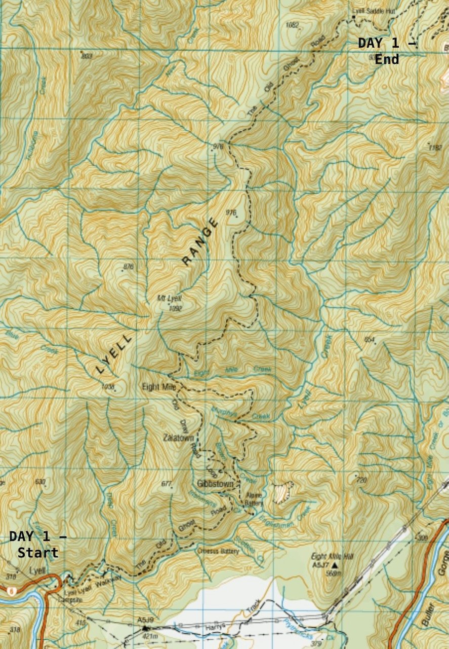
Lyell Campground to Lyell Hut ~ 12mi / 19 km; Ascent 2,774ft / 846m; Descent 237ft / 72m
We stood steps away from the threshold, underneath the rustic wooden arch, the words “The Old Ghost Road” burned into the beam, just out of reach, over our heads. A symbol in more ways than one about how I felt, having just locked about two-thirds of our gear away in a safe in the nearby shelter, to later be retrieved by Buller Adventures shuttle, delivered in 5 days to the Rough and Tumble Lodge at the other end on the Mokihinui River. We were committed to whatever lie ahead, our only intel a quick scan of the “Great Rides” App and The Old Ghost Road website.


~~~~~

Original Survey ~ “Spirit to the Stone”, by Marion Boatwright
Centuries ago, right where we had camped at the edge of a grassy field, a town of 1,000 once thrived off of those looking for gold in the Lyell Range. Deep in the bush we were about to enter, a long-forgotten dray road carved into the hillside in the 1880s survived for less than ten years before it was abandoned just beyond what is now Lyell Saddle. And in later years, earthquakes over 7.0 in 1929 and 1968 completely erased the upper section. The only evidence left of the road’s existence had been etched on parchment in 1886 when surveyors were attempting to connect it to another section of road along the Mokihinui River, now home to the Rough and Tumble Lodge. And that is where the dream that became The Old Ghost Road began - deep in the soul of a man from North Carolina, Marion Boatwright, in love with the upper West Coast of the South Island so much so, he had bought property and hand built a lodge with his partner along the Mokihinui River.
~~~~~~
After our ceremonial photos under the arch, I pushed off all of my unfounded fears and what-ifs. Our first challenge - how to get through the same type of gate Nivaun had so expertly navigated on the Waikato. Only this time the gate had been paired with a set of steps immediately after the gate, directly above the narrow suspension bridge connecting us to the dray road. If this was intended as a subliminal “streamlined” gear check or novice deterrent, it was not lost on me. Between Nivaun’s backpack and the fully packed pannier on each of our bikes, it was not an elegant descent down to the bridge. Thankfully, no gear was damaged and we had no witnesses.


Oddly enough, I had envisioned a trailhead packed with mountain bikers and bike-packers, similar to the Timber Trail, but that was not the case. Only one other (young) couple left before us, effortlessly passing through the same portal, kitted out with minimal lightweight gear, as recommended on the website introductory video.
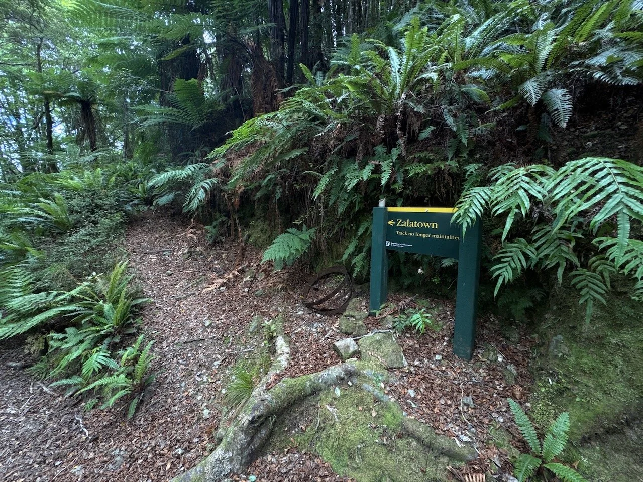
For most of the way, we had the trail to ourselves, and were surprised to find the ascent was an even 4-6% grade with only a few short, steep pitches. True to form, we lingered along the way stopping often to chat with the New Zealand Robins, our ever present companions, as we read interpretation panels, looked at historical relics and marveled at the reconstruction of the track where a major slip last year had closed the Lyell section until just a couple weeks before our arrival.

Better conditions than we imagined!


Even more impressive was the original reconstruction of the upper half of the trail, called “The Big Slips”, where the two major earthquakes had reduced the hillside to a rocky slab. Here the benched track was carved out by hand using ropes and a few strategic blasts by a crew of 14 camped along the trail, through winter, on the weekends. It was along this section that we met up with our first Department of Conservation (DOC) ranger, checking the condition of the trail and the pest traps astride a dirt bike. As our own park service crumbles, it is impressive to see New Zealanders commitment to maintaining these back country areas. Over more than half of the South Island is managed by DOC, while not perfect, it shows a sincere commitment to preservation as well as restoration.


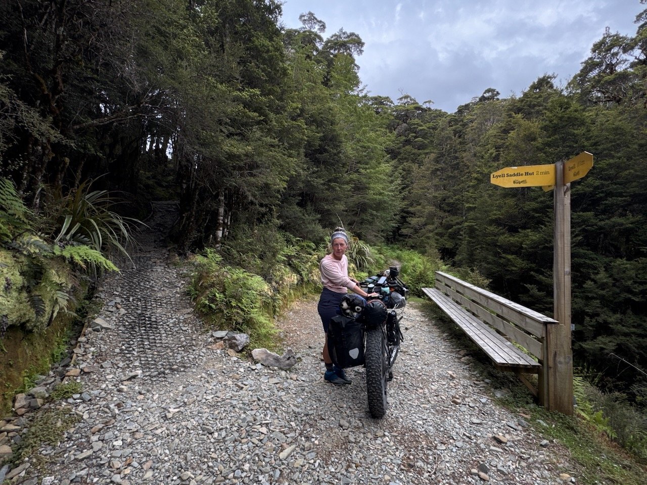
Before we reached the Lyell Saddle Hut, we were caught up by a local family of four tramping, a couple solo mountain bikers heading out, and another group of five mountain bikers riding the trail in three days.
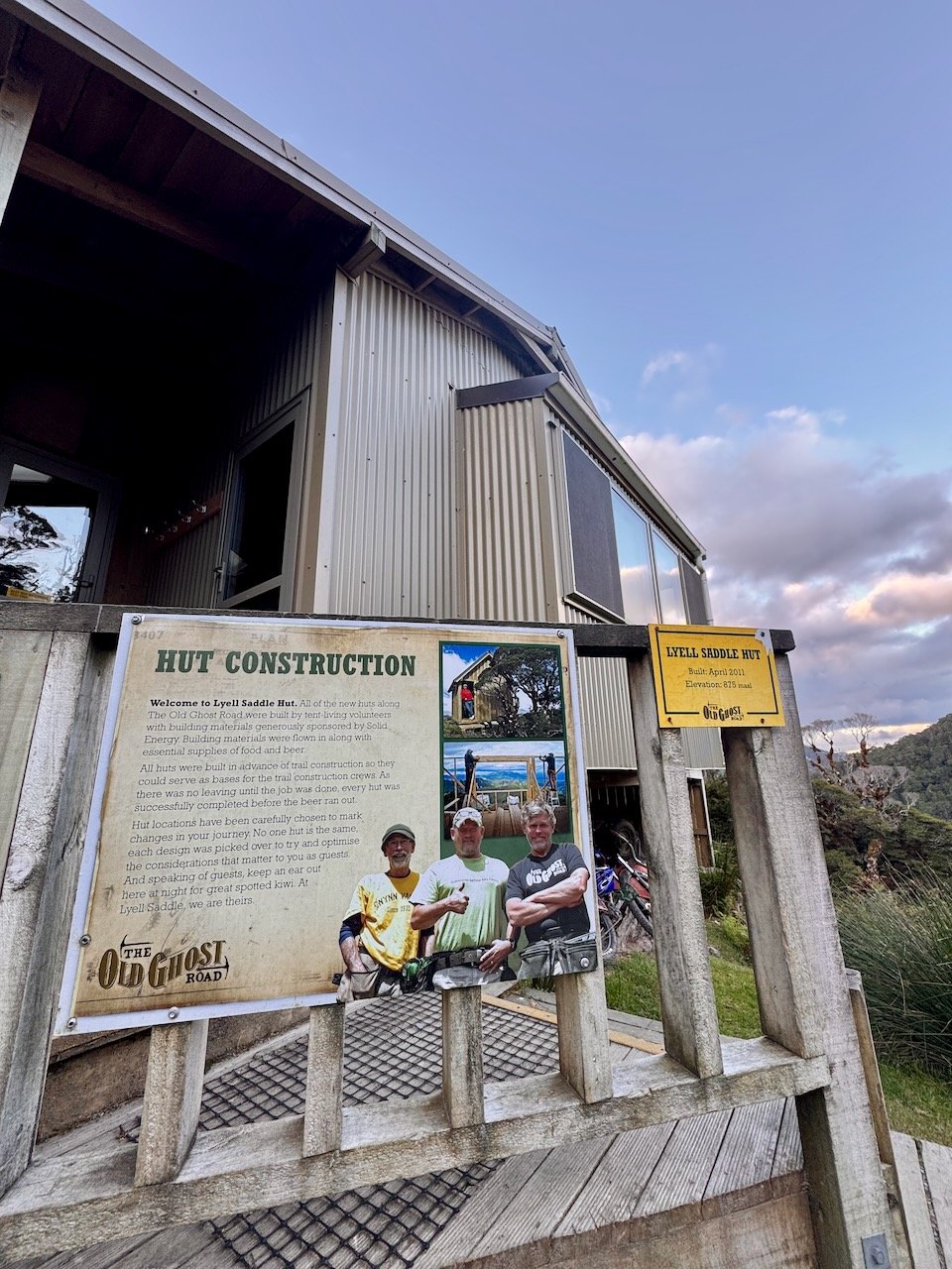
Surprisingly we arrived at the 18 km trail marker close to our usual time to make camp having ridden almost the whole section. Atop the saddle, the main hut was perched on a small clearing just big enough to accommodate a helipad, a couple composting toilets and best of all an outdoor shower room. Tucked back in the forest were two “Sleep-outs”, private huts with two full size bunks for 4 people, and in between a tent platform. Inside the main hut was a screen porch, communal kitchen and single bunk beds; outside, a deck with views across the valley where clouds lingered amongst the hilltops.


~~~~~
What we didn’t know yet is how pivotal the rebuilding of this first section of trail was to making the dream of connecting the two forgotten mining roads a reality. In 2007, Marion and his friend, a local bushman, first set out from Lyell to retrace the lines on the 1886 survey map all the way back to his lodge on the Mokihinui to determine how much of the two roads could be uncovered. To their surprise, remnants of the dray road reappeared but the mystery of how to connect it with the Mokihinui portion remained - presenting them with an irresistible challenge, right at a time when the future of the Rough and Tumble Lodge had been put in jeopardy by a hydro company proposing to dam the Mokihinui River, wiping out a section of his property and closing his lodge for up to 3 years. Rather than giving up, his pursuit to reopen this first section of trail became an obsession, as well as a distraction from forces out of his control.
With the whole-hearted support of the DOC Services Manager of the Buller Region, by the end of 2009, the dray road had been resurrected with a new section carved into the rock face, The Big Slips, to reach the top of the what is now Lyell Saddle. And that could have easily been the end of the story, but this man’s dream persisted as the future of his lodge remained in limbo.
~~~~~


By the time we were settled, with our 3-person tent pitched on the 2-person platform, the Sleep-out huts were full. The family of four we met tramping arrived shortly after us, and another couple from Adelaide had arrived earlier, ready to finish tramping the full length of the trail the next day. The group of five on MTBs and a woman tramping solo stayed in the main hut.
Rather than using a lottery to regulate use of the trail, the reservation system for the four huts along the trail, each with a single tent space, seemed to have the same effect. After catching up with our neighbors on the ground, we searched the treetops to find the source of the parrot-sounding calls overhead and discovered our first flock of Kakas, a native New Zealand forest-dwelling Parrot. Without question, this was to be “our ticket” for experiencing the true back country of New Zealand.


