
Incredible…The Old Ghost Road ~ Day 2, Jan 24

Lyell Saddle Hut to Ghost Lake Hut ~ 8mi / 13km; Ascent 1,945ft / 593m; Descent 845ft / 258m
Day Two: To Ghost Lake Hut

Looking back at the trail (thin line near the top of the ridge) across the backside of Rocky Tor - just before Ghost Lake Hut
The next section of trail is where this story becomes Incredible.
~~~~~~
Beyond Lyell Saddle, Marion and his friend, the bushman, had done more than one scouting mission through the South Branch of the Mohikinui only to find connecting the Lyell road to the Mokihinui road was on the one hand “tortured, untenable,” and on the other would take more than 35 bridges, affirming what the trail builders of the 1880s had already discovered. Any route was infeasible, even for a dreamer, but not impossible, from the birds-eye view of a helicopter.
In early 2010, right when additional funding was needed to pursue connecting the two roads, The New Zealand Cycle Trail leadership was taking bids for the expansion of Great Walks & Rides across the country and selected Marion’s proposal first, out of 54 projects, confirming his vision to build a world-class multi-use trail had merit. His newly formed Trust was awarded two million dollars - a fraction of the estimated cost, but enough to start.
After failed attempts to plot a route through the bush, it was the helicopter pilot of his small team with a perspective all his own that revealed the way forward. Flying them over “the Tops,” a route the pilot had flown to Lyell Saddle since the work to reopen the dray road began, infused the dream with possibility for an Incredible trail through world-class terrain. The key to linking the two mining roads had always been the Alpine.
~~~~~~
High clouds were with us all along the dray road, making our climb through the canopy that much more pleasant. As we left Lyell Saddle the next morning, just a few kilometers from breaking out into the Alpine, the thick clouds lingering in the hilltops threatened our chance to take in the expansive views across the Western ranges. The dray road now behind us, we both wondered whether the trail ahead would overtake our ability to ride, but the trail continued at a fairly reasonable grade with extended switchbacks through the last of the bush.
Here where the moisture-laden air hangs in the trees, the moss, lichen and fern were thriving even more intensely than just a few meters below. As we wove our way back and forth up the hillside, passing rain showers slowed our pace, whilst the ever present Robins continued to check our progress.


And then, a sudden break between both trees and clouds revealed the shoulder of Mt. Montgomery. A few more pedal strokes and we were at the edge of the tussocks, staring down the expanse of a valley to Murchison, and beyond never-ending ripples of ridge lines.
~~~~~~
This first 7km from Lyell Hut to the tree-line took us only an hour or so to ride, and yet it took the crew almost a year of painstaking tedious work to build. Unbeknownst to us, the geology had changed from greywacke to mudstone past Lyell Saddle up to the tree-line. Throughout the switchbacks were hand-cut narrow pieces of beech wood pressed lengthwise into the track, called “corduroy”. If not for this tedious work, the diggers used to clear the trail would have been sucked into the mud along with the crew.
~~~~~~


Riding amongst the clouds…simply, Incredible
We stopped at the Top Camp Emergency Shelter for lunch, more so to just simply take in the views in all directions - we had made it to the high country and it was as magnificent as our own. The magic that this elevation holds is so incredible and to be able to get here on two wheels is a feeling beyond words. Almost instantly, our pace slowed to a walk overcome by the desire to take in every new plant, flower, grass that adorned the open hillside.


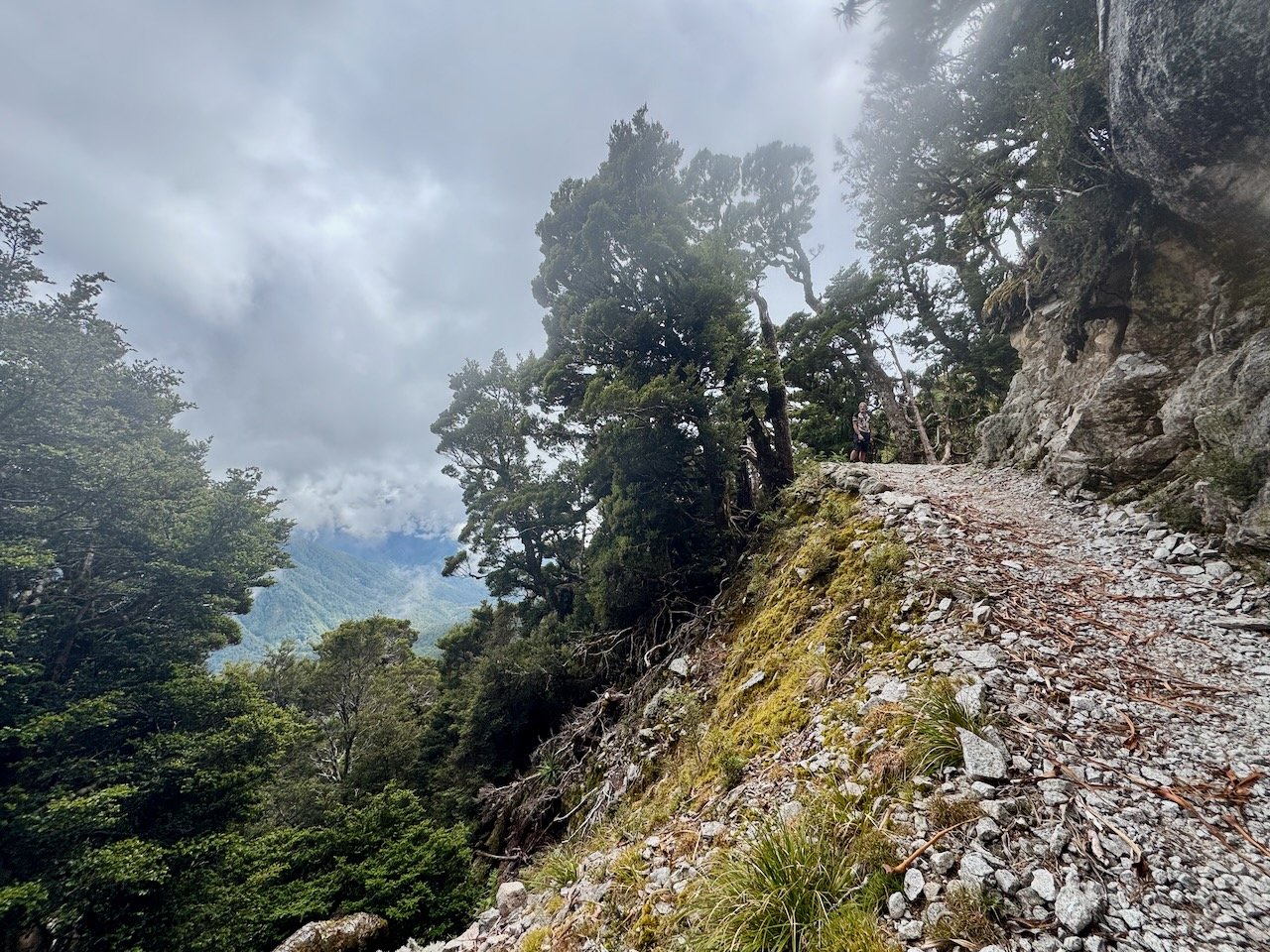
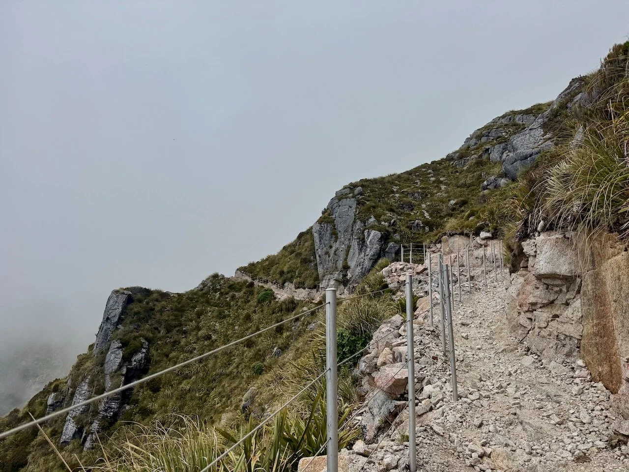
At the end of the tussocks on Bald Hill, the trail skirts along the top of the ridge approaching Rocky Tor and then drops off the other side exposing a sea of granite, and a thin line etched high on its flanks, revealing the traverse before us, as jaw-dropping as any I have ever hiked. With fenced railings to guard us on the rockier sections, we rode some, but walked more, just to keep our cameras at the ready, as the clouds slid across the hillsides, opening new vistas as we went. The Robins were no longer our constant trail companions. In their place, we met up with a scruffy little bird atop a boulder intent on holding its chosen perch next to the trail, while we snapped photos. Another native to New Zealand, the Pippit.

And so it begins…


The side hill traverse was so elegantly designed. Around every corner was another eye-catching display of granite with a stop mid-way through at the stunning gap in the ridge line behind Rocky Tor, aptly named “Heaven’s Door”, revealing the expanse of the valley below, as the clouds laced the tops of the surrounding ridge lines. Around the next bend, a massive boulder standing erect, atop another, just off the trail, “the Tombstone”. A juxtaposition to serve as a reminder of our tenuous existence where nature calls the shots. Beyond the granite spire was the remainder of the traverse, snaking its way along the undulating granite tops to a final viewpoint where we thought we could just spot a section of the Mokihinui Riverbed.

Heaven’s Door ~ A true “heaven on earth” kind of place. What a gift we were given so many millennia ago.


The Tombstone ~ the perfect place to be reminded how precious our short time on earth truly is
From there the trail quickly descended around the corner to a forested saddle, then slowly crept around the north side to reveal Ghost Lake Hut, unassumingly perched on a sheer cliff above a tarn, named after the trail itself. We had arrived at the pivot point to the most epic section of trail, hand-carved into existence on the shoulders of the Lyell Range descending into Stern Valley.


As if the day’s vistas weren’t sufficient to stir the wild in one’s soul, Nivaun staked out our tent on probably the most photographed tent platform in the South Island. Just below our vantage point of the surrounding ravines, a zipper made of granite traced its way down the nearby ridge, disappeared into the bush and reappeared criss-crossing its way up the other side. A preview of the excitement to come, a descent not meant for the faint of heart.


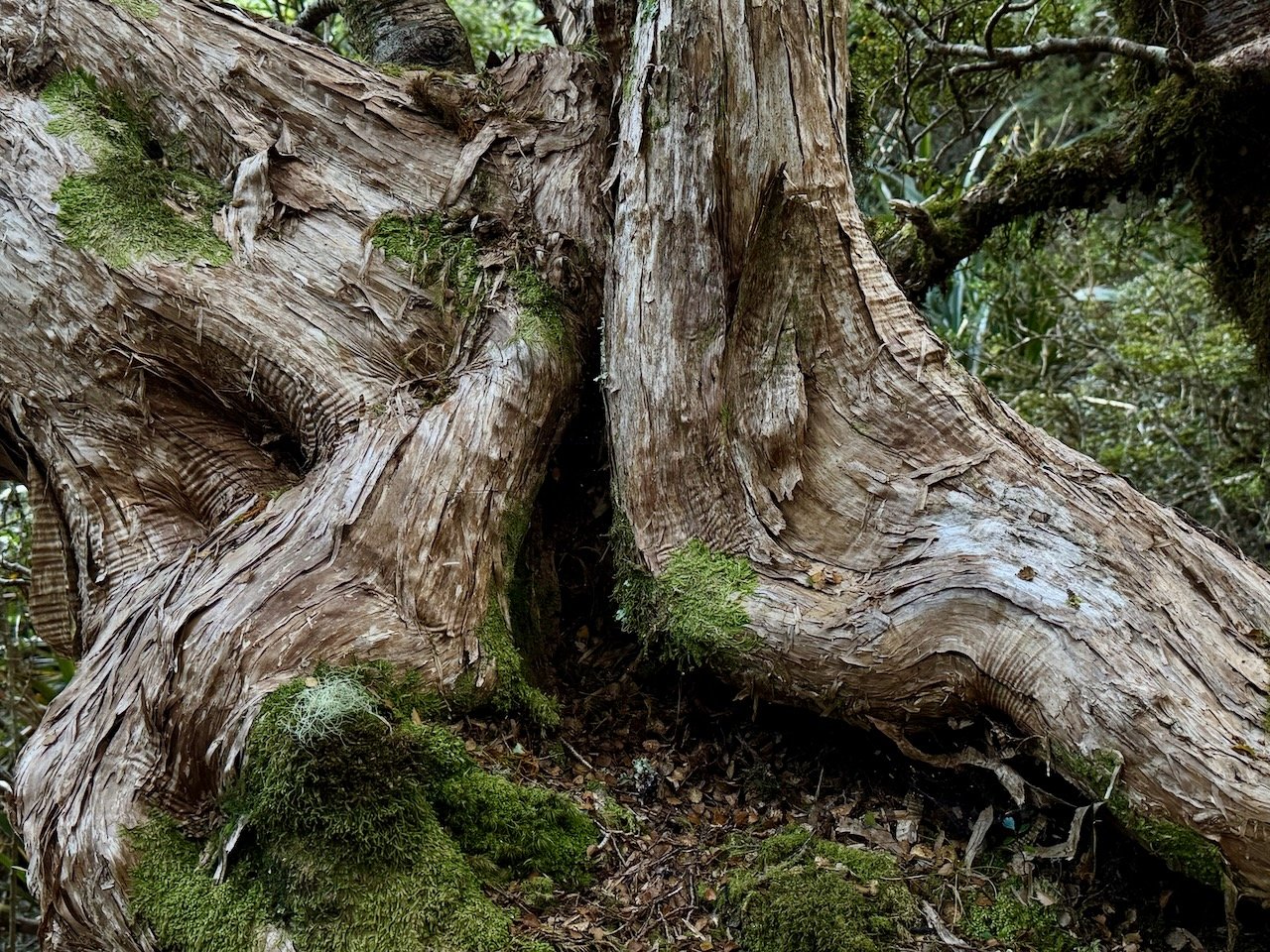
Anticipating rain in the forecast by noon the next day, we decided to walk down and spend some time at the tarn. A few steps away from the hut, before even reaching the basin, we were transfixed by the tangle of dwarfed trees draped in moss, their roots poured over and around moss-covered boulders, limbs wound together in an almost fluid-like embrace. It was becoming increasingly evident that every inch of this trail was going to be more enchanting than our minds could process or cameras capture.


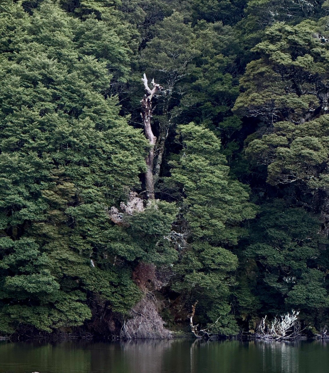


Ghost Lake Basin & Tarn
Back at the hut, we met one of the rangers stationed at Ghost Lake through the peak season. She graciously offered to check if one of the Sleep-outs might be available at Stern Hut, just in case it was “tipping it down” by the time we arrived. Our traveling neighbors had dwindled to the local family of four in the Sleep-out next to us, and the solo woman tramping had the main hut all to herself. At the suggestion of the ranger, she moved her sleeping mat atop a corner table in the main hut with a 180 degree view out the picture windows. This was backcountry leisure at its finest, inside and out.

Incredible view from the deck of Ghost Lake Hut